
Buscar
Mostrando ítems 1-10 de 19
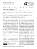
Effective roughness modelling as a tool for soil moisture retrieval from C-and L-band SAR
(Copernicus Publications, 2011)
Artículo / Artikulua,
Soil moisture retrieval from Synthetic Aperture Radar (SAR) using state-of-the-art backscatter models is not fully operational at present, mainly due to difficulties involved in the parameterisation of soil surface ...

Evaluation of TOPLATS on three Mediterranean catchments
(Elsevier, 2016)
Artículo / Artikulua,
Physically based hydrological models are complex tools that provide a complete description of the different processes occurring on a catchment. The TOPMODEL-based Land-Atmosphere Transfer Scheme (TOPLATS) simulates water ...
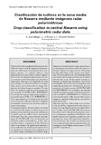
Clasificación de cultivos en la zona media de Navarra mediante imágenes radar polarimétricas
(Universidad Politécnica de Valencia, 2010)
Artículo / Artikulua,
Navarra lleva años empleando la técnica de clasificación
supervisada de imágenes multiespectrales
de satélite para la realización de la estadística
agraria. La cubierta nubosa, muy
habitual en esta zona, limita e incluso ...

On the assimilation set-up of ASCAT soil moisture data for improving streamflow catchment simulation
(Elsevier, 2018)
Artículo / Artikulua,
Assimilation of remotely sensed surface soil moisture (SSM) data into hydrological catchment models has been identified as a means to improve stream flow simulations, but reported results vary markedly depending on the ...
Factors controlling sediment export in a small agricultural watershed in Navarre (Spain)
(Elsevier, 2012)
Artículo / Artikulua,
It is recognised that the hydrological and erosion processes in watersheds are very much conditioned by
the (inter)action of a number of variables. This paper covers a 15-year period of studying those factors
that have ...
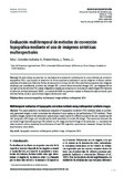
Evaluación multitemporal de métodos de corrección topográfica mediante el uso de imágenes sintéticas multiespectrales
(Asociación Española de Teledetección, 2014)
Artículo / Artikulua,
En este trabajo se presentan los resultados de la evaluación multitemporal de varios métodos de corrección topográfica (TOC), cuya bondad se determina de forma cuantitativa mediante el uso de imágenes sintéticas multiespectrales ...
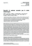
Desarrollo de productos avanzados para la misión SEOSAT/Ingenio
(Universitat Politecnica de Valencia, 2016)
info:eu-repo/semantics/article,
SEOSAT/Ingenio es la futura misión española de observación de la Tierra en el óptico en alta resolución espacial. Mientras que los productos de imagen a Nivel 1, radiancias geo-referenciadas a nivel de sensor, se encuentran ...
Synthetic images for evaluating topographic correction algorithm
(IEEE, 2013)
Artículo / Artikulua,
In the last years, many topographic correction (TOC) methods have been proposed to correct the illumination differences between the areas observed by optical remote sensors. Although the available number of TOC methods is ...

Multitemporal evaluation of topographic correction algorithms using synthetic images
(SPIE, 2012)
Contribución a congreso / Biltzarrerako ekarpena,
Land cover classification and quantitative analysis of multispectral data in mountainous regions is considerably hampered by the influence of topography on the spectral response pattern. In the last years, different ...

Automatic detection of uprooted orchards based on orthophoto texture analysis
(MDPI, 2017)
Artículo / Artikulua,
Permanent crops, such as olive groves, vineyards and fruit trees, are important in European agriculture because of their spatial and economic relevance. Agricultural geographical databases (AGDBs) are commonly used by ...
